The arctic blast arrives early this morning and already has Dallas Fire Rescue on multiple power line situations.
Dallas Fire Rescue has also responded to a major accident blocking traffic at Interstate 20 and Interstate 45. They also responded to a reported structure fire.
A strong cold front will blast through Dallas this morning. It will bring with it strong, gusty winds and sharply dropping temperatures. Outdoor items and holiday decorations should be secured!
The front should exit the region around noon.
Light snow is possible to the northwest of Dallas and there will be some movement to the east.
The snow will be dry and will be blown around by the wind resulting in no accumulation.
Other Side Dallas will continue to monitor and update throughout the next few days.
DFW Arctic Blast 2022 is on its way and will hit Thursday bringing with it reminders of power outages in 2021.
The National Weather Service is predicting much colder temperatures arrive on Thursday. A cold front will surge south across much of the United States.
The exact timing on the front is still somewhat uncertain.
The high temperature of the day for most will likely occur during the morning hours. Temperatures will then fall sharply throughout the day.
Peak wind gusts near 45 MPH are likely, and higher wind gusts cannot be ruled out. This will result in wind chill values in the single digits and teens.
DFW Arctic Blast 2022 – Prepare Now!
A major concern with the incoming weather is the possibility of power outages.
In early 2021 many in DFW experienced multiple days without power as ERCOT‘s inability to manage the Texas grid became apparent. ERCOT failed again six months later during the summer causing rolling blackouts.
One Emergency Manager suggested “charge everything – including back-up power banks – in the next day.”
Additional suggestions included filling gas tanks, having emergency supplies available including in your car, and preparation to be without power for a couple days.
Per NWS, strong to severe thunderstorms are expected across North and Central Texas.
Large hail, up to baseball size, and damaging winds and tornadoes are all possible. Hail may exceed 2″ at times along with a few strong tornadoes possible.
The greatest threat for significant severe weather will be between 3:00PM to around 9:00PM as a dryline acts as the focus for vigorous convection.
Other Side Dallas will update its newsfeeds on weather projections as they happen.
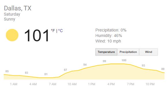
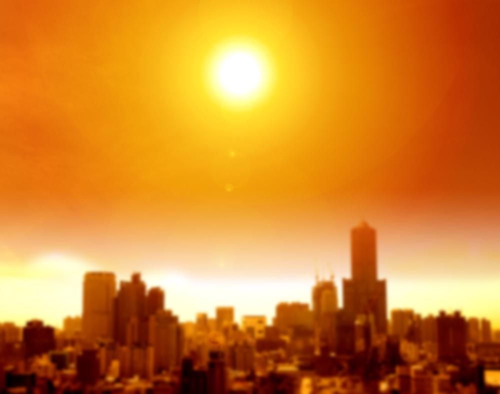
Hot hits 100°F today in DFW Weather. Per the National Weather Service the Dallas-Fort Worth are can expect their first 100°F degree day of the year today.
We are expected to have multiple days ahead above 90 – which is the temperature used to measure “Extreme Heat.”
Extreme heat means your body will work extra hard to maintain normal temperature. That can lead to death. Heat is responsible for the highest number of annual deaths among all weather-related hazards. Please keep in mind that Extreme heat can occur quickly and without warning. Older adults, children, and sick or overweight individuals are at greater risk from extreme heat conditions.
IF YOU ARE UNDER AN EXTREME HEAT WARNING:
Find air conditioning.
Avoid strenuous activities.
Wear light clothing.
Check on family members and neighbors.
Drink plenty of fluids.
Watch for heat cramps, heat exhaustion and heat stroke.
Never leave people or pets in a closed car.
HOW TO STAY SAFE WHEN EXTREME HEAT THREATENS
Prepare NOW
Find places in your community where you can go to get cool.
Keep your home cool:
Cover windows with drapes or shades.
Weather-strip doors and windows.
Use window reflectors, such as aluminum foil-covered cardboard, to reflect heat back outside.
Add insulation to keep the heat out.
Use attic fans to clear hot air.
Install window air conditioners and insulate around them.
Learn to recognize the signs of heat-related illness.
Be Safe DURING
Never leave a child, adult or animal alone inside a vehicle on a warm day.
Find places with air conditioning. Libraries, shopping malls and community centers can provide a cool place to take a break from the heat.
If you’re outside, find shade. Wear a hat wide enough to protect your face.
Wear loose, lightweight, light-colored clothing.
Drink plenty of fluids to stay hydrated. If you or someone you care for is on a special diet, ask a doctor how best to accommodate it.
Do not use electric fans when the temperature outside is more than 95 degrees, as it could increase the risk of heat-related illness. Fans create air flow and a false sense of comfort, but do not reduce body temperature.
Avoid high-energy activities.
Check yourself, family members and neighbors for signs of heat-related illness.
More 100°F Facts
Given the suggestion to curtail activity, Other Side Dallas has weather trivia you can enjoy over your ice cold drink. Dallas-Fort Worth experiences eighteen (18) days of 100°F heat annually. The average date for a first 100°F temperature is July 1. The last date is August 26.
In 1911, the Dallas-Fort Worth area experienced their first triple digit day on March 9. These big temperature days can happen late in the year too like on October 3, 1951. In 2011, we had 71 triple digit days.